You are here
Back to topMy Canada: An Illustrated Atlas (Hardcover)
$18.67
This item is not available this time
This item is not available this time
Description
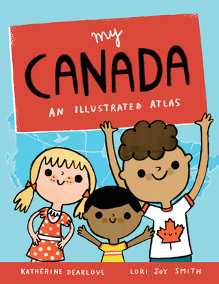
This picture book atlas of Canada is a whimsical, informative introduction to our country from sea to sea to sea. Each province and territory is featured on its own spread, with icons and labels indicating the capital city, other major cities, key lakes and rivers, iconic landmarks, animals, and plants, significant national and provincial parks, and more. Each map is lively and colorful with plenty of details to discover. Simple labels make key places and landmarks easily searchable for further research. Inspired by the illustrator's map of PEI, a longtime gift shop bestseller, My Canada includes basic information about Canada and a full map of the country. It's an excellent resource for celebrating Canada's sesquicentennial.
About the Author
Katherine Dearlove is a writer, researcher and editor. A former editor of chickaDEE and Chirp magazines, she has also been a senior editor for OWL Magazine. She lives in Brampton, Ontario. My Canada is her first book. Lori Joy Smith is a PEI artist and illustrator. My Canada was inspired by her original map of PEI, which she has been selling as a print and postcards in shops across PEI since 2014. Lori Joy has four picture books to her credit and illustrates regularly for Chirp Magazine. She has also illustrated for American Girl Magazine and for TV (Bobs & Lolo).